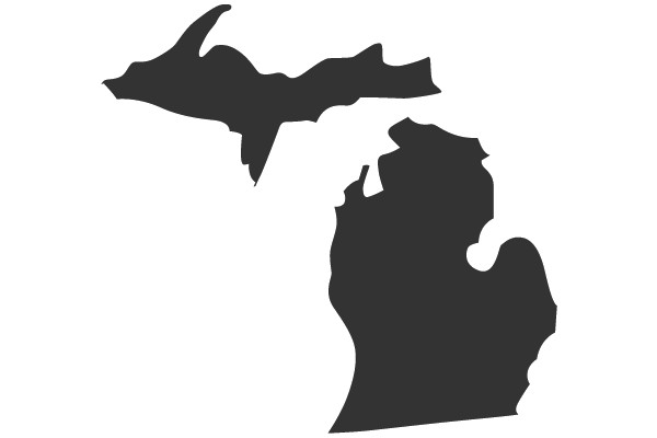
The image displays a stylized map of the state of Michigan, with the Upper Peninsula and the Lower Peninsula depicted in a simplified, graphic form. The Upper Peninsula is shown in a darker shade of blue, while the Lower Peninsula is in a lighter shade. The map is outlined with a thin black line, and the Great Lakes are represented by a lighter blue area surrounding the state. The image is flat with no shading, giving it a two-dimensional appearance. There are no texts or additional elements present in the image. The style of the image is minimalistic and appears to be a digital illustration rather than a photograph.
Like
Michigan State Map: A Visual Guide to the Wolverine State
$22.95 USD Sale price $20.00 USD
Design this TShirt
Design this Mug
Design this Sticker
Download for personal use
Product
Add to cartShare on Facebook
Share on X
Share on Pinterest
Other Designs